From the car park at Planina Kuhinja, the top of Krn is 1,250 metres higher, and there is almost no shade between you and it. This is the shortest marked route to the 2,244 m summit and it is technically easy. It is also a long, steady, south-facing climb that feels twice as hard after 11 a.m. in summer.
Krn is the big grey mountain north of Kobarid, the one you keep seeing from the middle of the Soča valley. The Kuhinja route climbs its south side on grass and an old military mule path, passes a small hut just under the top, and ends on a summit with Triglav on one side and the Italian plain on the other. Plan on 3-3.5 hours up, 2-2.5 hours down, and about 13.6 km round trip.
If you care more about the lake than the summit, go the other way. The forest climb to Krn Lake from Lepena comes up the north side and stops at the water, some 850 m below the top. From Kuhinja you look down on that lake from above. Pick Kuhinja if the summit is the point.
Getting to Planina Kuhinja
Kuhinja is a summer cattle pasture at about 1,000 m, above the village of Krn. From Kobarid, cross the Soča toward Smast and Vrsno, then keep climbing through Krn village. The last few kilometres are narrow with few places to pass, so take the bends slowly. Allow about half an hour from Kobarid. No bus goes up, so without a car you need a taxi from Kobarid.
You park on rough ground by the pasture buildings. In summer the pasture is working: cows, a small dairy, and a hut (Koča na planini Kuhinja) that opens daily from June through September. The dairy sells cheese from the Krn pastures, including tolminc, the local hard cow's cheese. Buy it on the way down. Nobody needs a kilo of cheese at 2,000 m.
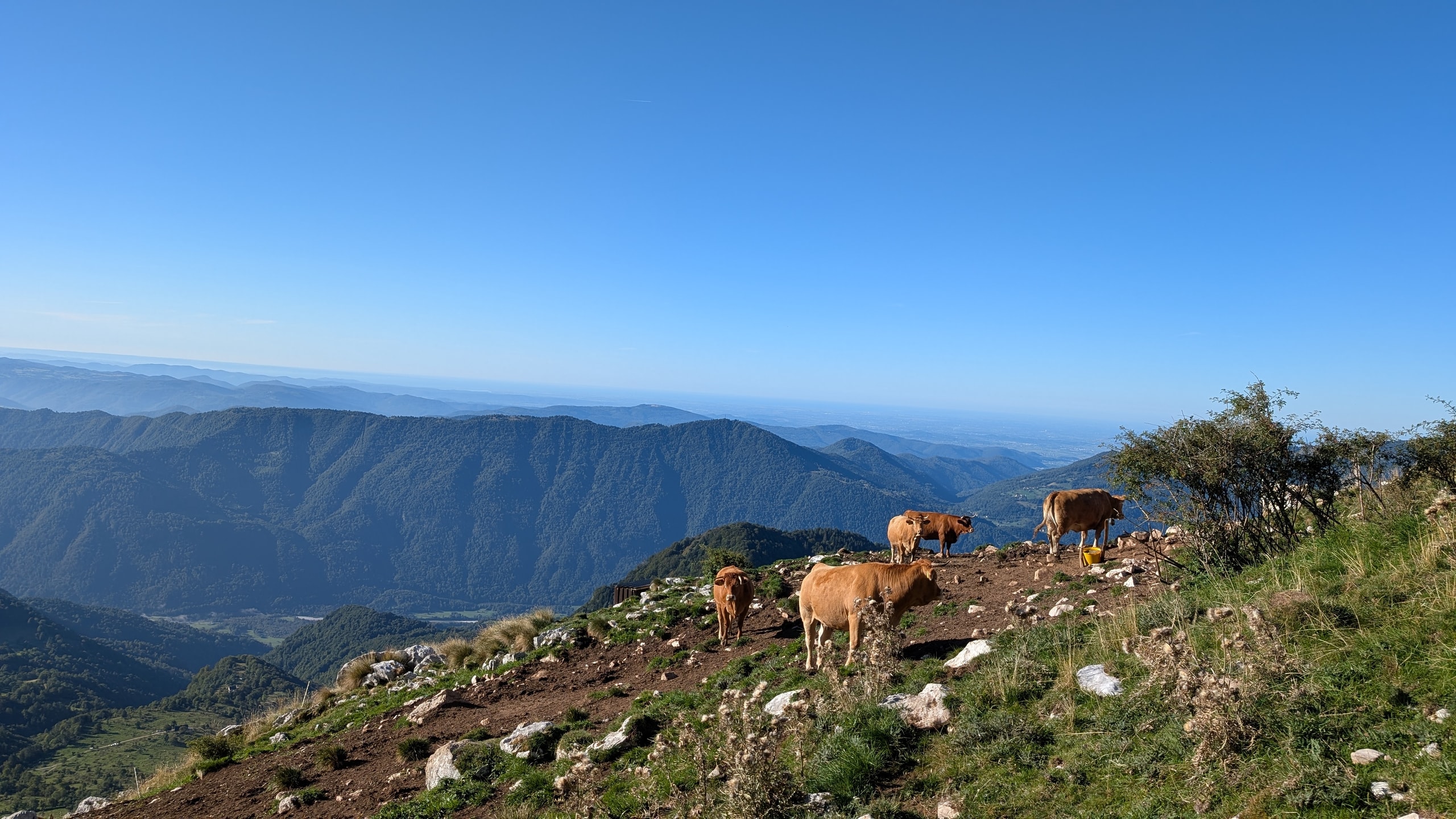
The cows use the path as much as you do. Walk around them, never between a cow and her calf, and close any gate you open.
The climb: grass, switchbacks, and no shade
Above the pasture the path climbs a broad grassy slope, then settles into long switchbacks. Much of it follows an old military mule track. During the First World War, Italian troops held the south side of Krn and needed to haul supplies up to the ridge, so the gradient is steady and even. That makes it easy on your breathing and a bit dull.
The sun is what makes it hard. The whole route faces south, and above the first pastures there are hardly any trees. On a clear July day the grass heats up fast, and there is no spring on the way. Carry at least two litres per person. The hut near the top sells drinks, but it is three hours away.
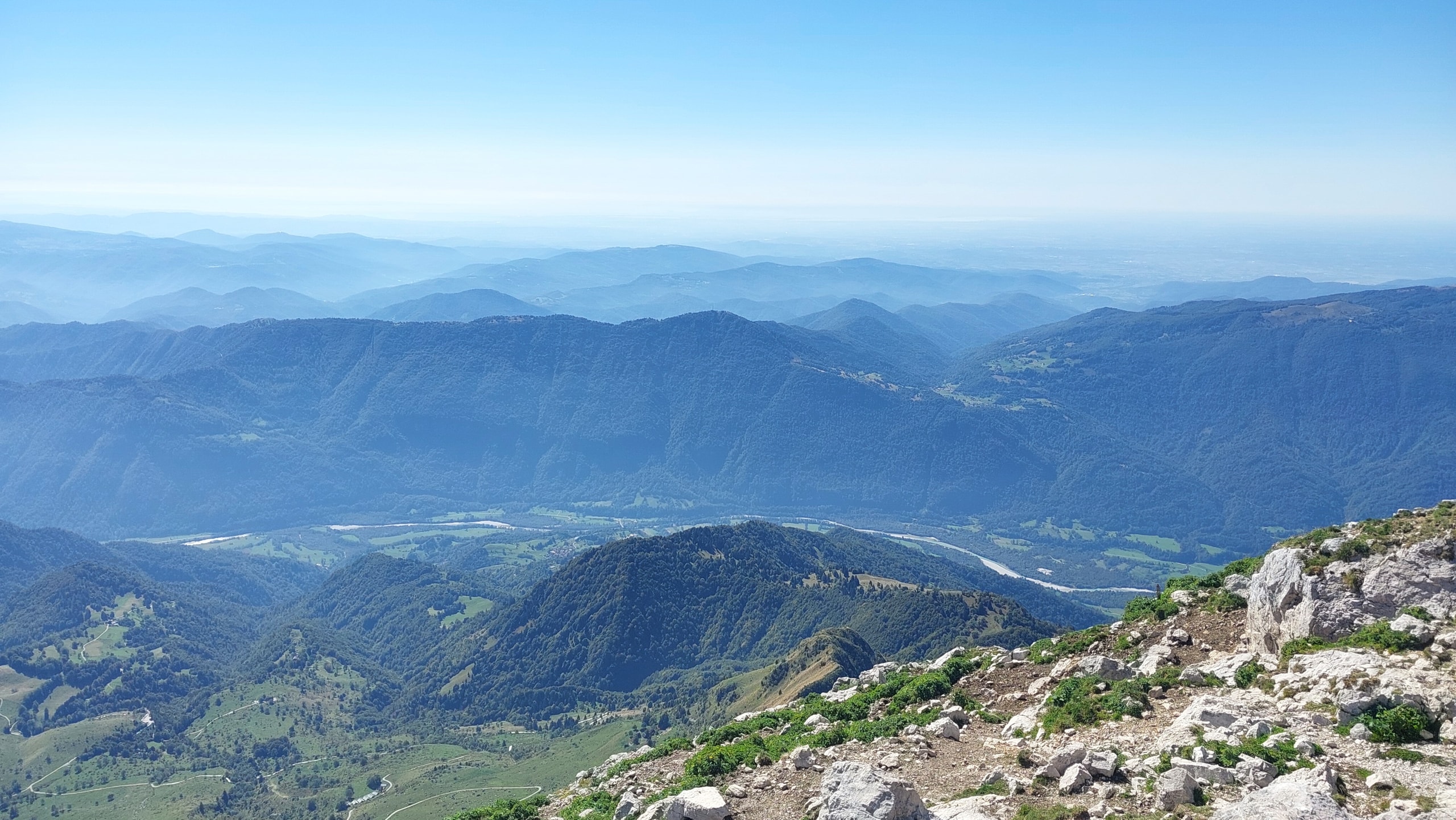
The view opens behind you as you go. The Soča runs pale and braided along the valley floor below Kobarid. The long wooded ridge across the valley is Kolovrat, which marks the Italian border, and past it the hills flatten into the plain. Cividale is down there somewhere in the haze. If you want a slow town day after the mountain, Cividale del Friuli is under an hour's drive from Kobarid.
The last hour: rock, the ridge, and the hut
Around 1,900 m the grass thins and limestone takes over. The path stays well marked, but now it steps over rock and loose stones. The normal route needs no helmet or via ferrata kit, though you may use your hands once or twice.
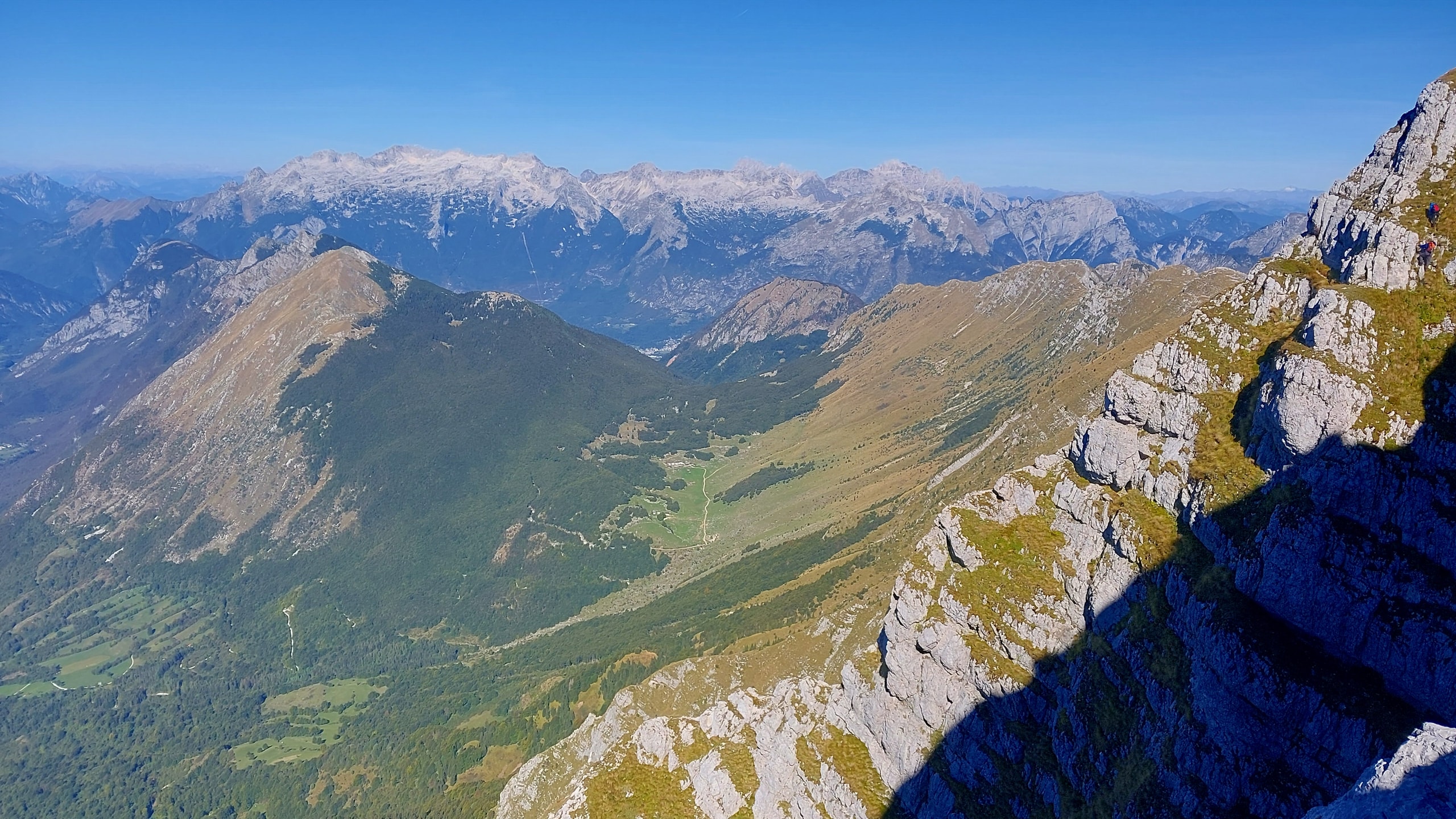
This is where the west view gets big. You look along Krn's grassy ridge to the Bovec basin, with the pale limestone of the Kanin range behind it. On a clear morning you can pick out the houses of Bovec.
Gomiščkovo zavetišče (2,182 m) sits just below the summit on the south side. It is a small shelter with dorm beds and a few tables outside. It opens from June 1 to the end of September, sometimes a little longer if the autumn is dry. Expect jota (bean and sauerkraut stew), sausages, strudel, and cold drinks. A hot dish runs roughly $9-14 and a beer or soda $4-6. Bring cash. From the hut, the summit is about ten minutes up.
On the summit: Triglav, Krn Lake, and the Adriatic if you are lucky
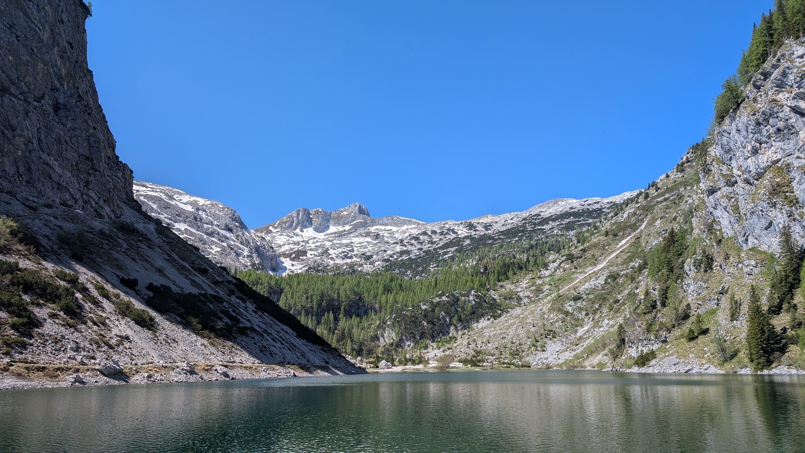
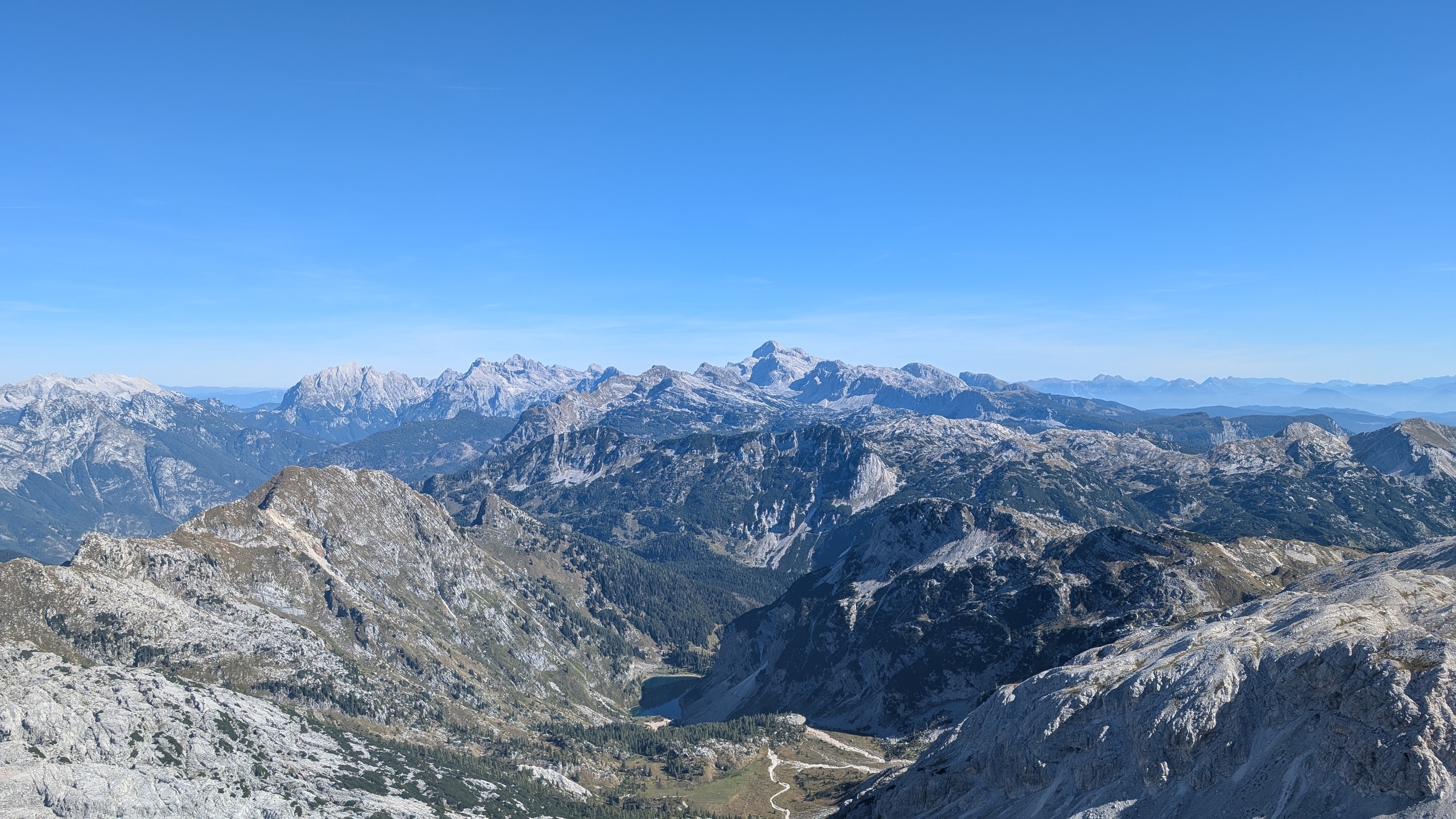
Turn north-east at the top and the view changes completely. Triglav (2,864 m) stands in the middle of the skyline, the tallest peak in a long line of grey ones. Straight down, in a deep green bowl, sits Krn Lake, the dark water in the photo at the top of this page. From up here it looks like a puddle. It is Slovenia's largest high-mountain lake.
To the south, on a very clear day, you can see the Adriatic. In late summer the plain is often hazy by mid-morning and the sea disappears. It is a bonus, so do not plan the day around it.
The First World War is still on the mountain
Krn was a front line for more than two years. Italian Alpini took the summit in June 1915, and the front then held along this ridge until the Austro-Hungarian and German breakthrough at Kobarid (Caporetto) in October 1917. Around the summit and along the ridge east toward Batognica, you walk past trenches, dry-stone walls, shelters cut into the rock, and rusted wire. Batognica, the peak next door, was mined so heavily that its top is lower than it was before the war.
Stay out of the tunnels unless you have a headlamp and know where they lead. Leave any metal where you find it. The ridge is part of the Walk of Peace, a trail that links the WWI sites along the Soča. For the full story, spend an hour in the Kobarid Museum the day before or after. A ticket is about $9, and it makes the trenches on the ridge much easier to read.
Coming down takes longer than you think
You descend the same way, and it takes 2-2.5 hours. The rocky top section is slow because stones roll under your boots, and the long grassy switchbacks are hard on knees after 1,250 m of climbing. Poles help a lot. In July and August thunderstorms often build over the Julian Alps after lunch, so aim to be off the rocky part by about 1 p.m.
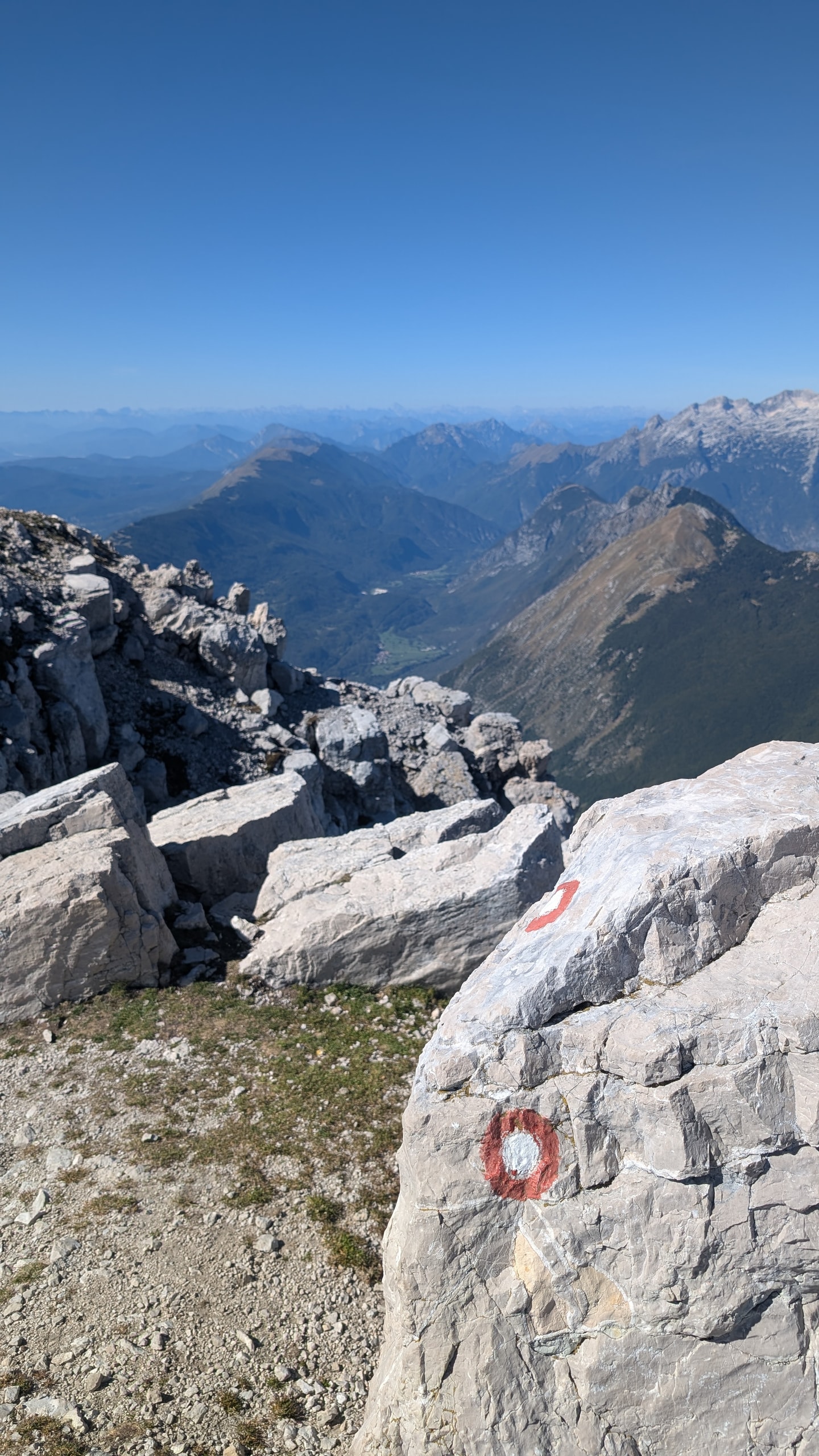
In fog, these marks are what keep you on the route. People cut corners between the switchbacks, and those shortcuts wear the slope away and often end on loose ground.
Cost, timing, and when to go
- Route: Planina Kuhinja (about 1,000 m) to Krn (2,244 m). About 1,250 m of climbing and 13.6 km round trip. Allow 6-7 hours with breaks.
- Difficulty: Easy technically, hard physically. Not a good first mountain if you have never climbed more than 500 m in a day.
- Cost: The trail is free. Lunch and a drink at the hut run $12-20 per person. A dorm bed at Gomiščkovo zavetišče costs roughly $25-40 if you want to stay up for sunrise.
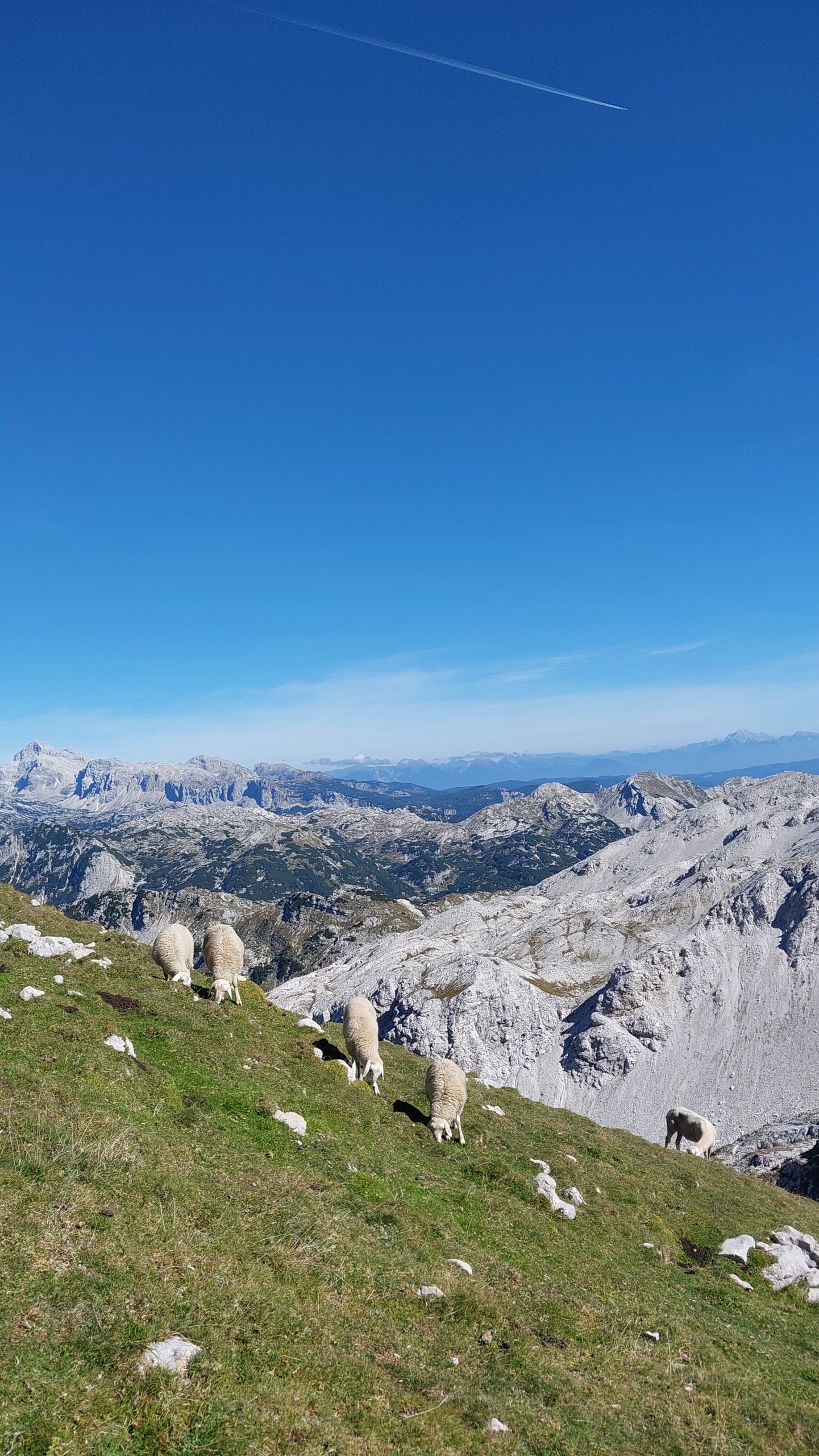
- Season: June to early October. Early June can still have snow in the upper gullies. July and August are the hottest months on this slope, so start by 7 a.m. Late September is the best time: cooler climbing, clear air, and the sheep are still grazing near the top. Both huts close at the end of September, so after that you carry everything yourself.
- Base: Kobarid is closest, with simple doubles around $70-110 a night. Bovec has more choice and is 30 minutes further. Other Slovenian hikes and towns are on the Slovenia page.
Kuhinja or Lepena?
Choose Kuhinja if you want the summit in a day with the least climbing and you can handle a lot of sun. Choose Lepena if you want the lake, more shade, and an easier day. If you have two days, climb from Kuhinja on day one, sleep at Gomiščkovo zavetišče, and walk the ten minutes to the top before sunrise. You watch the sun come up over the Julian Alps and have the summit to yourself until the day hikers arrive.